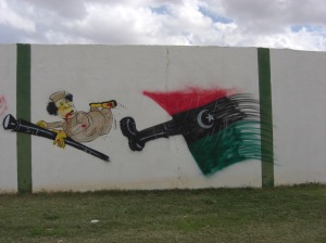
The People Want …
01/03/2011 at 21:49 | Posted in Libya | Leave a commentTags: 17 February Revolution, Benghazi, Libya
The People have risen, fresh colors of Libya
28/02/2011 at 23:37 | Posted in Libya | Leave a commentTags: 17 February Revolution, Benghazi, Libya
A Story of Two Bridges
01/03/2010 at 15:25 | Posted in Cyrenaica | 59 CommentsTags: Wadi al Kuf, Wadi al Kuf Bridge
NOW
Wadi al Kuf (sometimes written as Wadi el Kouf) is a valley in the Green Mountain (Jebel Al Khdar) of Cyrenaica in eastern Libya about 180 kms east of Benghazi. The name el Kuf most probably comes from the word Ku-huf in Arabic meaning caves, which are seen all around the valley walls. In ancient times it had another name as Wadi e Jerreib وادي الجريب .
Wadi al Kuf Bridge at present is the largest steel cable and concrete bridge in Libya. It connects the two mountain cities of Al Marj and Al Bayda. The Bridge pillars rise majestically 160 meters above the Wadi al Kuf, and can be seen from a long distance. It was designed by the Italian engineer Riccardo Morandi and was constructed by the Italian company C.S.C. between 1965 and 1971, at a cost of 5,300,000 US Dollars.
BEFORE
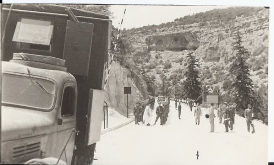
The only means to cross Wadi al Kuf, at ancient times, was to walk or ride down to its bottom from east or west and coming up at its other side. After the Italians colonized Libya, they had built a small bridge connecting both sides at the wadi bed. Later on, this bridge was destroyed by fighting armies in Second World War.
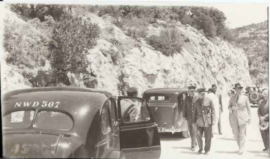
In 1948, during the British Administration after the war and before independence of Libya, the British Army Engineers (R.E.M.E.) built a new bridge, which remains are still in existence at the wadi bed.
The pictures below show the opening ceremony by Emir Idris El Senussi (not yet King of Libya at the time). These pictures are a courtesy of my friend M. Jean-pierre Misson, whose father, Capt. Robert Misson, a Belgian in the British army since 1941. Capt. R. Misson was a Liaison Officer between the British Administration and the Emir Idris El Senussi, and he appears in the following pictures (1, 2, 3, 4, 8 and 11) as the civilian wearing light coloured dress and sunglasses.
An Update (30/07/2010):
The following pictures were taken when the old bridge was erected by a member of the ” British” Royal Engineers ( who erected the bridge and not the REME ) as was noted by our friend JMR of RE in the comments below.
I thank friend JMR again for his contribution now and then.
Benghazi Beaches in Winter
23/01/2010 at 01:23 | Posted in General | 1 CommentTags: Beach Walking, Benghazi Beaches, Nature's Sculpture
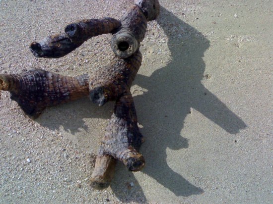
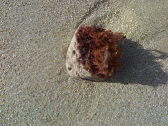
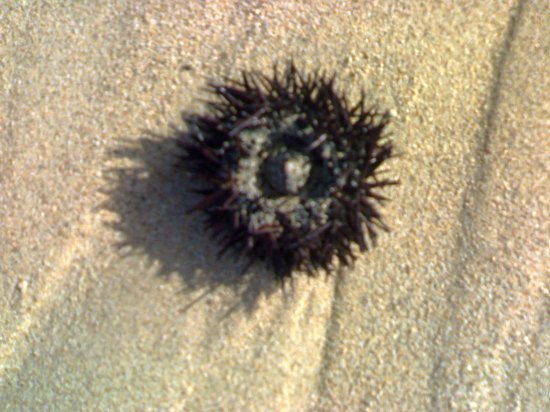
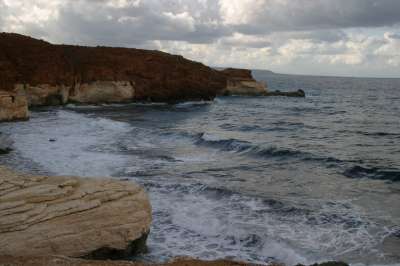
Benghazi has lovely beaches at both its shores – to the west and east. These beaches offer its inhabitants a lovely sanctuary in summer time, and in winter they are pleasant places for walking and enjoying both the lovely scene of the sea in its violent phase of the year and breathing fresh air. Walking on one of this beaches shows you the wonder of nature in creating its sculptures by the repetitions of its strong waves on sandy beaches. At one of those walks, I took those pictures.
Wadi el Kouf
28/12/2009 at 23:56 | Posted in Cyrenaica | Leave a commentTags: : Wadi el Kouf, Jarjarummah, Jebel Lakhdar
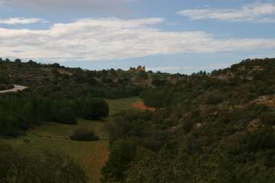
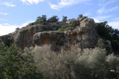
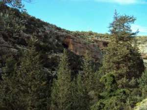
Wadi el Kouf is situated in the Jebel al Akhdar massif of Cyrenaica about 180 kms east of Benghazi and near the town of Beida further east. Wadi el Kouf stretches for 10 kms from west to east, forming from its basin with its tributaries wadis the source of the great Jarjarummah wadi which flows into the Mediterranean sea. The view is a spectacular one of towering cliffs and high caves, along with wild trees and bushes of all kinds. The Wadi area is covered by dense Mediterranean maquis scrub. ” There are essentially three main vegetation habitats: a) maquis; b) coastal dunes flora; and c) wadi vegetation.” More information is available … HERE.
These are some pictures of this beautiful area of the Green Mountain taken last Friday.
Ptolemais Ruins
15/12/2009 at 01:00 | Posted in Cyrenaica | 1 CommentTags: Cyrenaica, Greek Ruins, Ptolemais
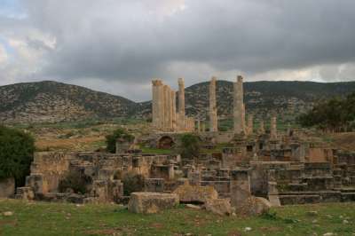
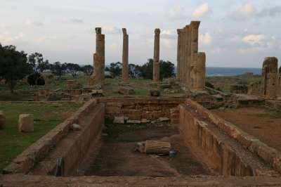
Ptolemais is situated about 120 km east of Benghazi city, and it lies between the Mountain and the Sea Shore. This city must have been a lovely city indeed. “Ptolemais or Ptolemaida was one of the ancient capitals of Cyrenaica. It was probably named after Ptolemy III Euergetes. Its Latin name in Roman times was Tolmeta, from which the modern Libyan town of Tolmeitha – Arabic طلميثة – derives its name. The town was most probably founded originally in 6th century BC by settlers from Barka as a port for their city. Soon it became one of the founding city-states of the Pentapolis federation. In 331 BC the union was dissolved after all of its towns surrendered to Alexander the Great. After his death the area formed part of the Ptolemaic empire. In early 1st century the region was conquered by Rome and became a separate province. This information and more is found … Here ..
Today, Ptolemais lies in ruin and neglect, but still, it remains a part of our history that we can’t deny. The whole area is occupied by several shepherds and their sheep, while the modern town of Tolmeitha garbage dump is located nearby in one of the ravines. The museum of Tolmeitha is a very modest one indeed, and the road leading to it from the present town is in need for much repair.
However, the beauty of Ptolemais and its ancient history and spirit is always there and can’t be overlooked. You find the area in its most natural splendor by mid winter and early spring when all flowers are blooming and it is green all around. Here are some pictures that were taken two years ago.

Between the Mountain and the Sea
12/12/2009 at 11:22 | Posted in Cyrenaica | Leave a commentTags: Apollonia, Cyrenaica Coast, Erythron, Ras al Hilal
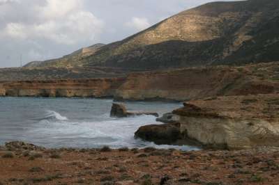
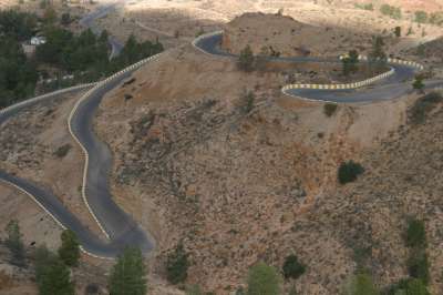
The coast of Cyrenaica stretches for about 300 kms, from Tokrah (Tauchera ) in the west to Derna in the east. Unfortunately, there is no coastal road between the mountain and the sea that runs all this area. There exists a small road that connects Tokrah (Tauchera) with Tolmetha ( Ptolemais ) , however on the other side , there is a beautiful modern highway that starts from Soussah (Apollonia) to Derna, passing through Ras al Hilal and Lathroun ( Erythron ) featuring probably the most spectacular scenery in all Libya of the mountain and the sea . These are some pictures of this beautiful area.

Abughilan
03/12/2009 at 11:30 | Posted in Tripolitania | Leave a commentTags: Abughilan, Jebel Nafusa, Mountains
Traveling 70 km south of Tripoli city you face a formidable wall of hard rock. That is Jebel Nafusa, Jebel Gharyan or Al Jabal Al Gharbi(The Western Mountain).
Abughilan is your entry gateway to capital of the mountain region of old, Gharyan, or Ett-gassat اتغسات as well known by its local name, meaning ‘The Centre المركز’ or the ‘Reunion الملتقى’ in the ancient tongue of the peoples of Nafusa.
The mountain rises abruptly from the desert plain of Jefara to a height of over 750 meters, with a highest peak of a modest 968 meters. The mountains are awe-inspiring, bare, rugged, savage and without vegetation, however the fertile plains on the mountain high plateau are full of olive, fig , fruit trees and vineyards.
Abughilan means in English ‘The Father of Ghouls’. The terrible sound of the Gibble wind howling between the rocks of mountains and surrounding valleys probably inspired this fearful name to ancient travelers walking its man-made tracks on foot, donkey and horseback.
The modern road of Abughilan might have been tracing the tracks of the ancient Roman highway that was built by slaves during Roman times. When the Italians invaded Libya they built the first new asphalt road climbing up in the mountain, which in turn was repaired after independence. Another modern beautiful freeway was built during the seventies, after the revolution. As soon as you drive up the winding road and reach the top, you find many shops of ceramics on both sides of the road selling all kinds of pottery of which Gharyan is well-known.

A Cry for Freedom
18/11/2009 at 23:20 | Posted in General | Leave a commentTags: Birds and Freedom
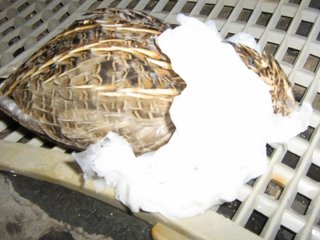
A couple of years ago, I was driving with my daughter to Tauchera and Al Marej area just to wonder in the countryside and take some pictures. I was driving on the coastal road when, looking in the back mirror, I noticed something lying in the middle of the road that looked vaguely like a small animal or a bird. I stopped and drove in reverse until I arrived where it was. Eventually, it was a bird, a migrating one I guessed, hit by a car in its wing and it couldn’t fly anymore. My daughter wanted to take it home and try to treat it until it gets well, so we put it in the car and drove on.
And so that’s how it came to our house where my daughter put it in a spare cage and provided it with food and water and tried to ease its wound by spilling water to it.
She kept doing so for few days until she thought it got better and became in a good shape to fly. However, whenever approached it became very violent and tried to fly out hitting the roof and sides of the cage. It wasn’t tame neither thankful at all!
One week later, we took the cage and drove outside of town to the farms area near the airport of Benina where we stopped at a friend’s farm and put the cage on the ground and opened the door and there it was!! It just jumped out of the cage; it made such a piercing joyous cry (at home it never made a sound) and flew away like a bullet toward the trees!!!
I looked at some books and found out that that bird could be what we call in Arabic Gunbraقنبرة . It is a migrating bird that comes from the north to the African coast in Autumn looking for the warm climate in Winter time and it only makes a singing sound very rarely and only to express joy.
COULD THAT HAVE BEEN A CRY FOR FREEDOM?
BEFORE

AFTER
The Lady of Silphium
04/11/2009 at 22:16 | Posted in Books | Leave a commentTags: Cyrene, Greek cyrenaica, Silphium
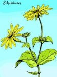
Christina Söderling-Brydolf from Sweden, drove her Landrover accompanied with her daughter Caterina, into Libya for the first time in 1968. Both of Christina and her daughter enjoyed sightseeing around in the Jabal Lakhdar of Cyrenaica, and visited the Pentapolis. Christina read about the founding of Cyrene by the Greek settlers of Thera under their leader Battus, to become later, first king of his line of eight kings ruled Cyrene for 200 years. She knew then, of how the famous plant Silphium, provided the economic basis for the development of Cyrene which flourished into a state of great prosperity and a high cultural level. The Cyrenaic coins from 600 to 250 B.C. bearing the images of Silphium are a testimony of its importance.
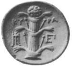
Silphium of which Roman poet Catullus sang:
near Cyrene, where Silphium is gathered,
between the shrine of Jupiter the sultry
& the venerable sepulchre of Battus!
… was a medicinal plant curing many diseases and considered as an Elixir of Life which cost its weight of gold in the civilized world then. The plant was collected by Libyans and its exportation to Egypt and Europe was the monopoly of kings of Cyrene.
Christina left Libya later and back in Cairo she discussed the subject of the plant with her Swedish friend, the Botanic Professor in Cairo University, Vivi Tackholm. Gradually, she became obsessed with the idea of going back to Libya and undertaking a project of searching for any trace of this plant which was extinct centuries ago. She met Lully Bjorkenheim, a Finish Lady, in Cairo who volunteered to accompany her in her odessy whenever she wanted to.They met each other later on, in Stockholm, in February the following year and studied all the information available on Libya, its ancient and modern history and what the ancients left of lore on the plant Silphium which the Romans called lasarpicium. On 23rd February, 1969, they drove from Stockholm towards the South, and from Naples they sailed by boat to Benghazi. I have to remind you that Christina was in her late fifties and Lully was in her late sixties at the time. It must have been quite a spectacular view for the inhabitants of Jabal Lakhdar to see those two rather old ladies who were touring the area between Cyrene, Appolonia, Beda, Grenada and Ras El Hilal in their Landrover looking for any trace or relative of this mysterious plant, and collecting what they suspected close to their objective.
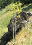
They continued making their devout search. They looked up in the hills and down the valleys and the ravines, and near the coast of Cyrenaica, and they naturally didn’t find any Silphium related plant apart of the plant ferula which the Libyans called derias and knew to be poisonous to man and beast. Lully was particually interested in the Greek catacombs and the caves hoping to dig up some burried treasure. They drove around the area between Beda, Slonta, Cyrene, Appolonia, Ras el Hilal and Derna. They became acquainted to the weird –but friendly- Miss Briton who lived in Ras el Hilal village under the protection of the King who was a first customer of her special natural honey product of her fantastic beehives. Miss Briton lived there for fifteen years already, she was very interested in Libyan history, old and present and knew a lot about plants.
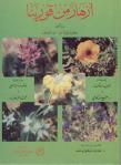
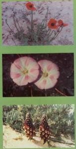
At the end, they didn’t find any Silphium, but Christina left us a most beautiful book telling of her adventures in Cyrenaica, telling of Libyan history, past and present, and displaying information about Cyrenaica wild flowering plants. She wrote of her contacts with Libyans, with the Libyan administration and with few foriegners whe they met in Shahat and Soussa. The plant specimens the two ladies ghathered were later sent form Tunis city to Stockholm to be analysed in a Botany Lab. The book is called (Blomman I Cyrene) or, Flora of Cyrene, which is translated into Arabic under the supervision of Dr. Hadi M. Bulghma and published by the University of Gar Younis, Benghazi.
Blog at WordPress.com.
Entries and comments feeds.

